Eastern Bangkok Under Water
Days of non-stop rain — nearly 300mm — left eastern Bangkok underwater, all eastern canals full, 15 major roads flooded and all 50 districts declared disaster zones, with risk lingering through Sep 27.
AI-generated summary of publicly reported news, human-moderated. Non-commercial personal archive — photos remain the property of their respective publishers.
Rain began at 4pm on Thursday and barely stopped for two days. By Saturday morning, eastern Bangkok was heavily flooded: every canal on that side of the city was full, and 15 main roads were deep under water. All 50 Bangkok districts were declared disaster zones to speed up the flood response. More water was still flowing in from Nonthaburi and Pathum Thani, and a low-pressure system kept rain circulating over Greater Bangkok. Western Bangkok, on the other side of the Chao Phraya River, stayed dry.
the rain begins
Persistent rain starts over Bangkok and keeps going. A low-pressure area settles in — its centre tilted towards the eastern side of the capital — feeding moisture across Greater Bangkok.
Sources: Bangkok Post, 26 Sep 2026 · The Nation, 25 Sep 2026
the warnings stack up
- Overnight rainfall reaches 133mm, plus another 30mm through the day, across Khlong Sam Wa, Sai Mai, Min Buri and eastern areas to Lat Krabang
- TMD forecast: rain over 80% of central and eastern Thailand, including Bangkok; heavy to very heavy rain nationwide through Sep 27, flash-flood risks and rough seas — small boats in the upper Gulf told to stay ashore
- Pathum Thani on red alert: Rangsit canal at critical level with 28 million m³ of accumulated water upstream
- Khao Yai National Park closed for two days (Sep 26–27) after flash floods raised landslide and rockfall risk
- Gov. Chadchart warns residents along eastern canals — Min Buri, Lat Krabang, Sai Mai especially — to move belongings to higher ground
- BMA runs pumping and drainage at full capacity: Phra Nakhon-side pumps moving 1,200 m³/s, pushing canal water through Saen Saep, Phra Ong Chao and Prawet canals towards the Phra Khanong sluice gate and the Chao Phraya
- Government orders 24-hour health monitoring in flood-risk areas
 08-hero · 2026-09-25
Flood conditions in Bangkok as canal levels reached critical stage. Photo: The Nation
08-hero · 2026-09-25
Flood conditions in Bangkok as canal levels reached critical stage. Photo: The Nation
 06-canal-pressure · 2026-09-25
Eastern Bangkok canals under pressure from persistent heavy rain. Photo: The Nation
06-canal-pressure · 2026-09-25
Eastern Bangkok canals under pressure from persistent heavy rain. Photo: The Nation
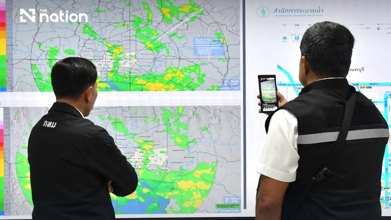 07-bma-drainage · 2026-09-25
BMA pumping and drainage operations moving canal water towards the Chao Phraya River. Photo: The Nation
07-bma-drainage · 2026-09-25
BMA pumping and drainage operations moving canal water towards the Chao Phraya River. Photo: The Nation
eastern Bangkok under water
Nearly 300mm accumulated in Min Buri, Klong Sam Wa and Saphan Sung by morning. Governor Chadchart Sittipunt's morning briefing:
- All 50 districts declared disaster zones to accelerate the flood response
- All eastern canals full — pumping can't keep up; people near canals at risk
- Floodwater flowing into the capital from Nonthaburi and Pathum Thani
- 15 main roads heavily inundated; waist-deep water at Bang Kapi intersection near Saen Saep canal
- Cell broadcast alert at 9:22am — DDPM warning: canal water levels critical and rising, especially canal-side and low-lying areas; move belongings and valuables up, avoid travel
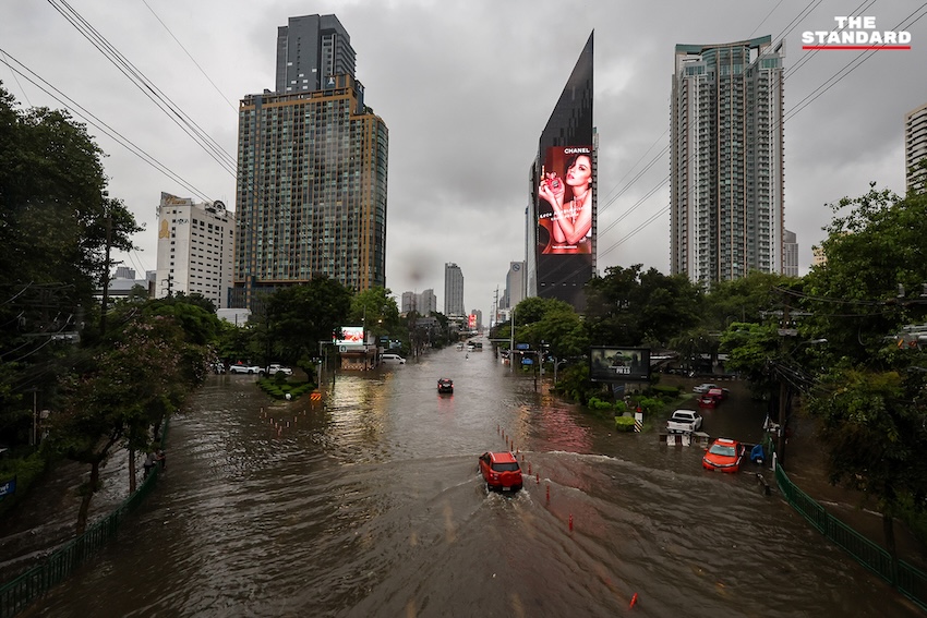
- Phetchaburi Road (Makkasan–Asok) — Saen Saep canal water overflowed onto the roadway on top of the rain; floodwater submerged car wheels, leaving cars and motorcycles stalled mid-road for officials to push clear; motorcyclists rode the sidewalks to get through
- CAAT warned travellers to Don Mueang and Suvarnabhumi to allow extra time — flooded roads and poor weather disrupting travel and delaying some flights
- Shoppers stock up as flooding empties convenience-store shelves; Commerce Ministry orders supply and price checks in flood-hit areas
- Bedridden people in flooded areas to be moved to hospitals; shelters open at BMA schools
- Sandbags available at district offices; if rain stops, water should recede within ~6 hours
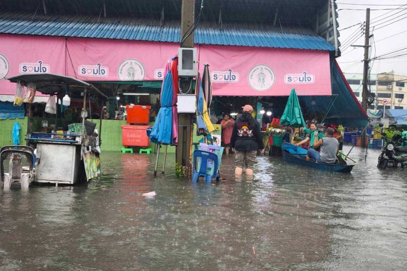 01-prachaniwet-market · 2026-09-26
Prachaniwet 1 market, Chatuchak district. Photo: Ananya Moonphen / Bangkok Post
01-prachaniwet-market · 2026-09-26
Prachaniwet 1 market, Chatuchak district. Photo: Ananya Moonphen / Bangkok Post
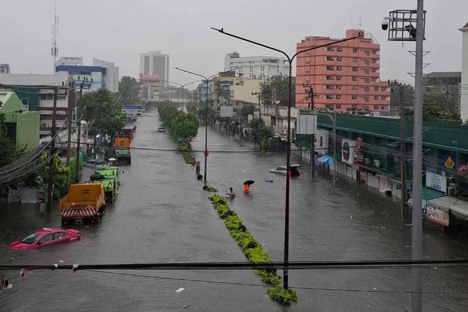 02-nawamin-road · 2026-09-26
Nawamin Road near Bang Kapi intersection. Photo: Lat Phrao police station / Bangkok Post
02-nawamin-road · 2026-09-26
Nawamin Road near Bang Kapi intersection. Photo: Lat Phrao police station / Bangkok Post
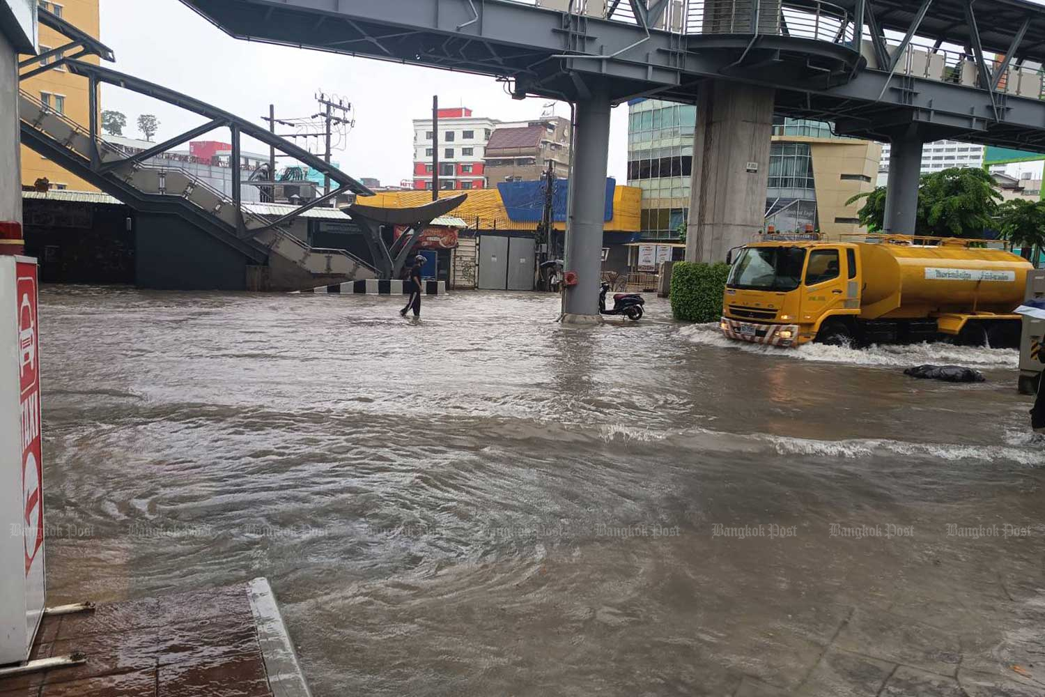 03-phahon-yothin · 2026-09-26
Phahon Yothin Road at Ratchayothin intersection. Photo: Nareerat Wiriyapong / Bangkok Post
03-phahon-yothin · 2026-09-26
Phahon Yothin Road at Ratchayothin intersection. Photo: Nareerat Wiriyapong / Bangkok Post
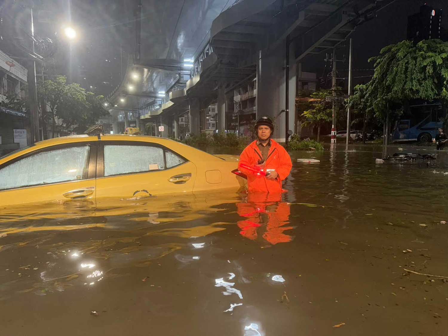 04-bang-kapi-intersection · 2026-09-26
Waist-deep floodwater at Bang Kapi intersection near the Saen Saep canal. Photo: Lat Phrao police station / Bangkok Post
04-bang-kapi-intersection · 2026-09-26
Waist-deep floodwater at Bang Kapi intersection near the Saen Saep canal. Photo: Lat Phrao police station / Bangkok Post
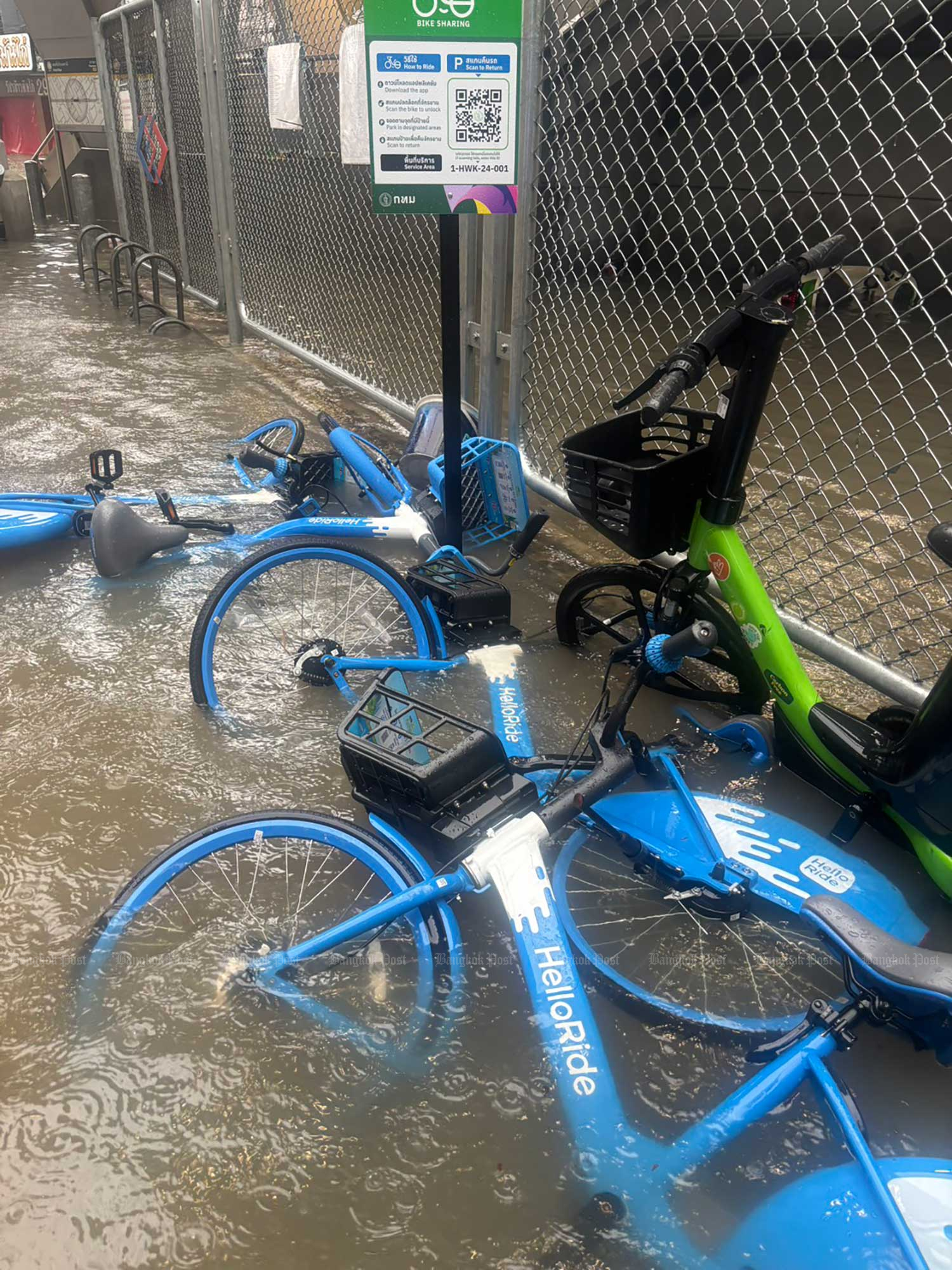 05-lat-phrao-41 · 2026-09-26
Lat Phrao 41 Road in Chatuchak district. Photo: Charoen Kittikanya / Bangkok Post
05-lat-phrao-41 · 2026-09-26
Lat Phrao 41 Road in Chatuchak district. Photo: Charoen Kittikanya / Bangkok Post
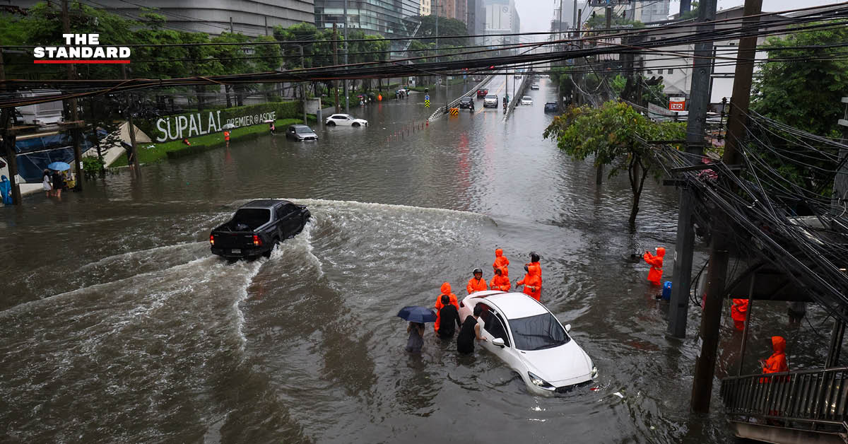 09-phetchaburi-aerial · 2026-09-26
Phetchaburi Road near Makkasan–Asok under floodwater after 48 hours of rain. Photo: Thanis Sutto / THE STANDARD
09-phetchaburi-aerial · 2026-09-26
Phetchaburi Road near Makkasan–Asok under floodwater after 48 hours of rain. Photo: Thanis Sutto / THE STANDARD
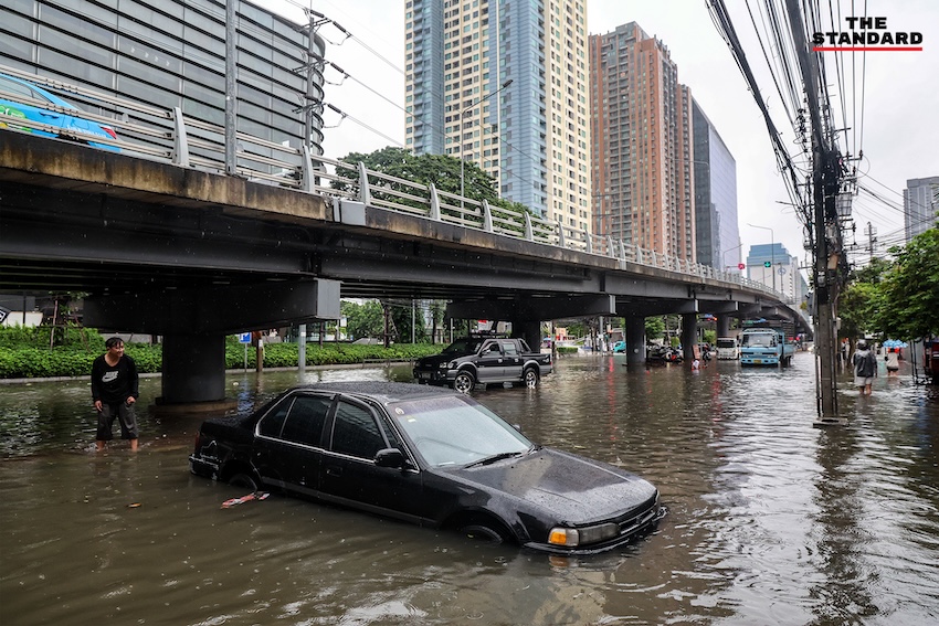 11-phetchaburi-wading · 2026-09-26
Residents wading out for food and supplies. Photo: Thanis Sutto / THE STANDARD
11-phetchaburi-wading · 2026-09-26
Residents wading out for food and supplies. Photo: Thanis Sutto / THE STANDARD
 12-phetchaburi-scene · 2026-09-26
Phetchaburi Road during the floods. Photo: Thanis Sutto / THE STANDARD
12-phetchaburi-scene · 2026-09-26
Phetchaburi Road during the floods. Photo: Thanis Sutto / THE STANDARD
risk lingers
The low-pressure system is expected to shift gradually westwards and away, with conditions likely easing after Sep 27. Until then the flood-risk warning for eastern Bangkok stands — residents near canals should keep valuables and vehicles on higher ground. BMA coordination continues with Samut Prakan and Chachoengsao, both also dealing with severe flooding; water cannot simply be pushed from Khlong Prawet east into Chachoengsao because irrigation canals and farmland stand in the way (Royal Irrigation Department controls that flow).
Sources
- Eastern Bangkok under water — Bangkok Post, 26 Sep 2026
- 48 hours of rain: Phetchaburi Road under high floodwater, stalled vehicles everywhere — The Standard, 26 Sep 2026
- All 50 Bangkok districts declared disaster areas — Bangkok Post
- Bangkok sends cell broadcast as canal levels reach critical stage — The Nation
- CAAT warns heavy rain may disrupt travel to Bangkok airports — The Nation
- Bangkok shoppers stock up as flooding empties convenience-store shelves — The Nation
- Commerce orders supply and price checks in flood-hit areas — The Nation
- Chadchart warns eastern Bangkok of flood risk until Sept 27 — The Nation
- TMD forecasts rain across 80% of central and eastern Thailand — The Nation
- Pathum Thani faces critical flood warning as Rangsit canal rises — The Nation
- Khao Yai closes for two days as heavy rain raises landslide risk — The Nation
Photos: Bangkok Post, The Nation, THE STANDARD. Last researched 26 Sep 2026.